Trusted by teams at
USPS and Canada Post licensed data — address validation, radius search, autocomplete, demographics, boundary files. API or download.
{
  "code": "10001",
  "code_type": "ZIP",
  "country": "US",
  "city": "New York",
  "state": "NY",
  "state_name": "New York",
  "county": "New York",
  "county_fips": "36061",
  "location": { "lat": 40.7484, "lon": -73.9967 },
  "timezone": { "iana_name": "America/New_York", "abbreviation": "EDT" },
  "demographics": "██████ (include=demographics)",
  "census": "██████ (include=census)",
  "congressional_district": "██████ (include=congressional_district)"
}
Trusted by teams at
API access to U.S. ZIP Code and Canadian Postal Code data. U.S. Address validation, radius search, autocomplete, and 13 years of demographic enrichments. Free tier includes 2,500 credits/day.
GET /v2/quick-zip?code=90210&key=YOUR_KEY

{
  "city": "Beverly Hills",
  "state": "CA",
  "county": "Los Angeles",
  "location": { "lat": 34.1031, "lon": -118.4163 }
}USPS-licensed database with 90+ columns. Geocodes, demographics, time zones, CBSA, and more. Immediate download with monthly updates.
Canada Post-licensed database with geocodes, population, area codes, time zones, and Postal Code Conversion Files.
Complete USPS ZIP+4 database with street address data, Census Block Group, carrier routes, and geocoding. Address-level precision.
ZIP Code boundary data in Shapefile, GeoJSON, KML, and more. Built for mapping, GIS applications, and geospatial analysis across the United States.
These lookups run on the same licensed data available via our REST API and downloadable databases.
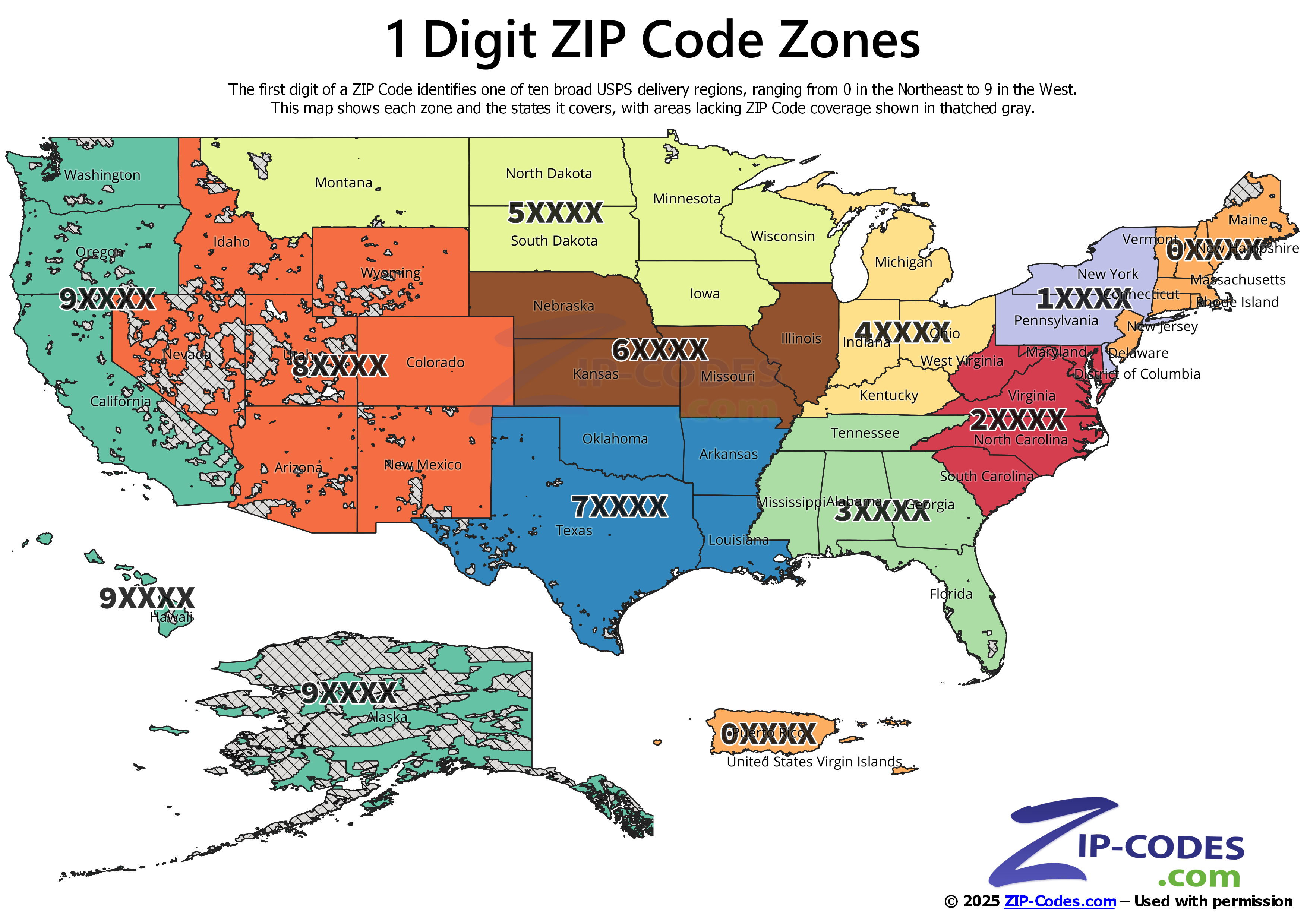
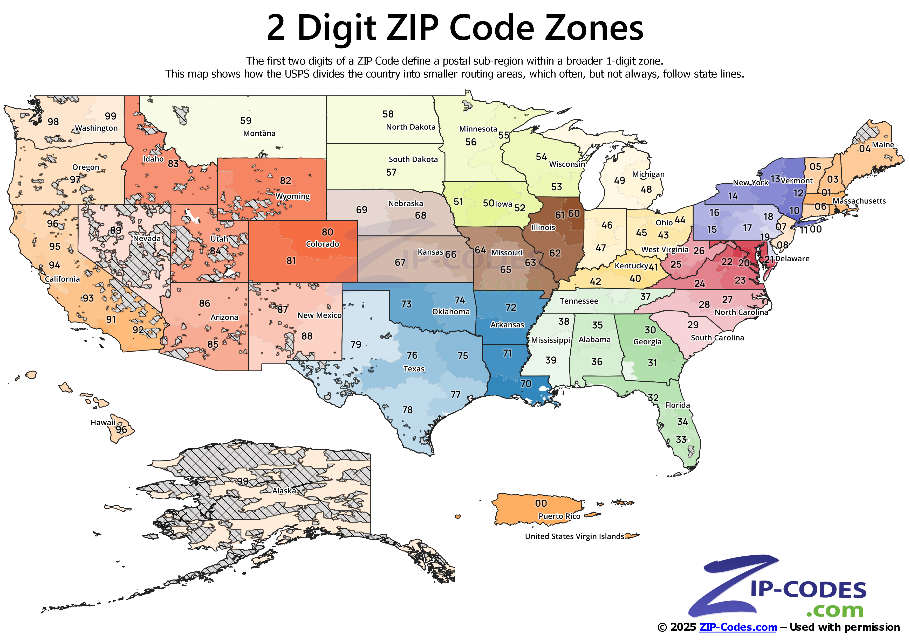
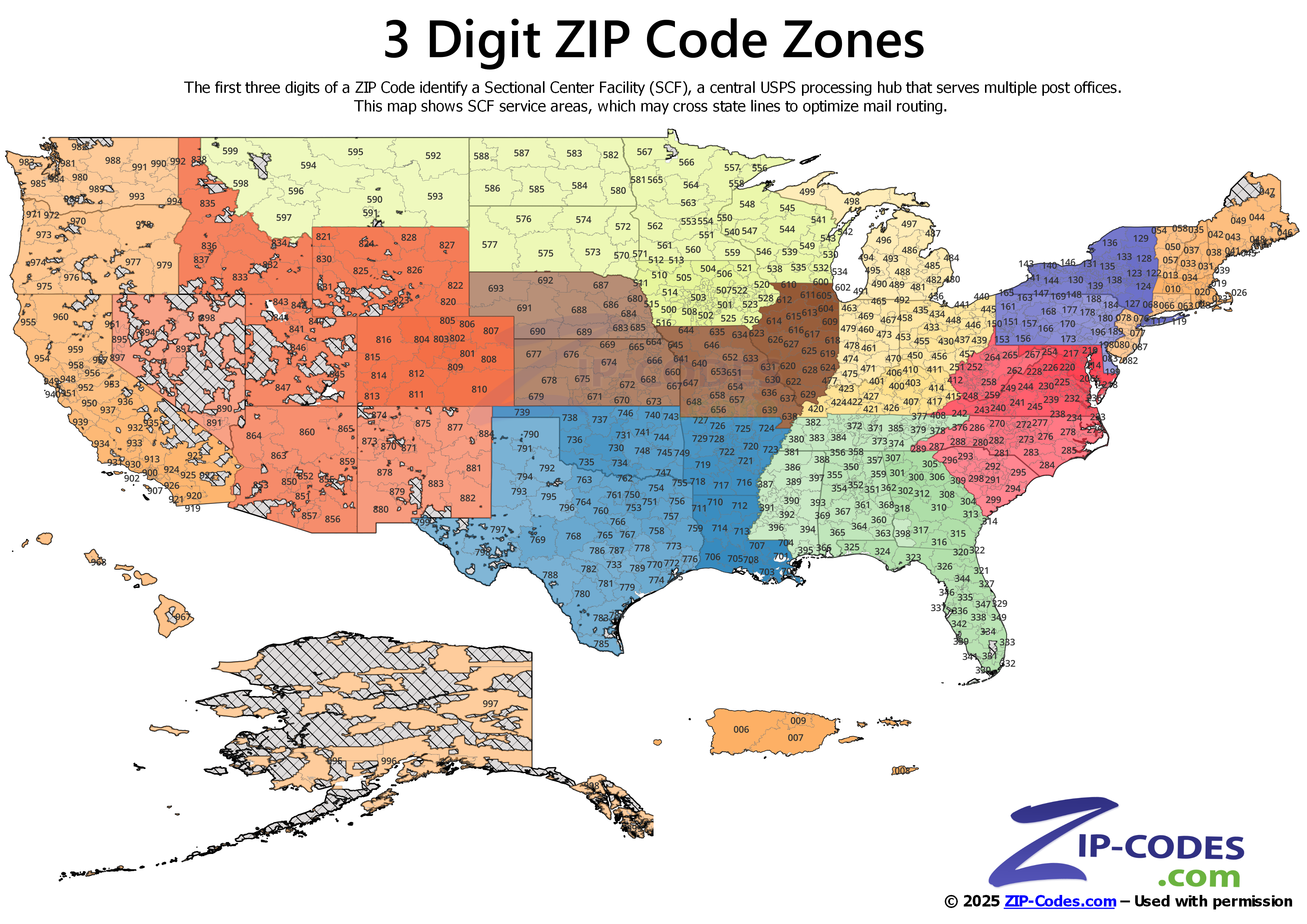
USPS distribution zones visualized at three levels of precision — essential for logistics planning, sales territory definition, and geospatial analysis.
 Full size
Divides the U.S. into 10 broad postal regions (0–9). Northeast through West Coast. Ideal for national-level sales territory design and executive reporting.
 Full size
More granular sub-regional boundaries. Used for franchise territory planning, regional distribution strategy, and mid-level market segmentation.
 Full size
Sectional Center Facilities (SCFs) — the most operationally precise level. Critical for logistics routing, insurance rating territories, and address-level geospatial analysis.
 Full size
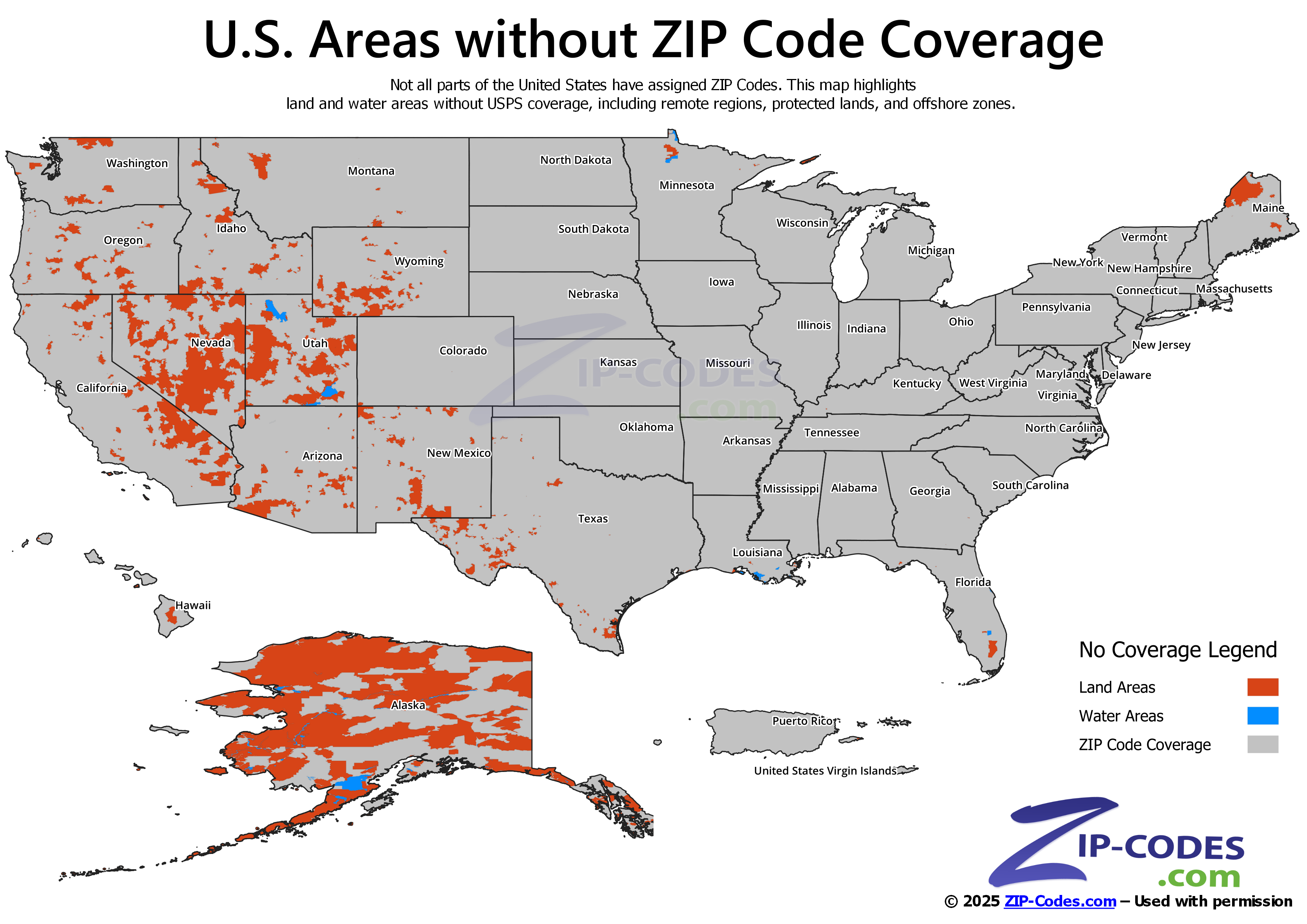
U.S. wilderness areas, national parks, and remote regions without ZIP Code assignment. Essential for data validation and address coverage QA.
These maps are built from our ZIP Code Boundary Data — available in Shapefile, GeoJSON, KML, and more.
See how teams use our data to power critical business operations.
Optimize shipping zones, validate delivery addresses, and calculate distances for fleet routing and fulfillment operations.
Enrich datasets with demographics, income, and housing data. Define trade areas and analyze market potential by ZIP Code.
Embed ZIP Code lookup, autocomplete, and radius search into your application via REST API. Ship location features in minutes.
Territory management, risk scoring, and regulatory compliance with FIPS codes, congressional districts, and Census boundaries.
Patient routing, service area definition, and Medicare region mapping with ZIP-level demographic and socioeconomic data.
Segment customers by geography, enrich lead data with location intelligence, and power direct mail campaigns with validated addresses.
Licensed USPS data distributor since 2003 and authorized Canada Post distributor. Over 84,000 businesses, government agencies, and universities rely on ZIP-Codes.com for business-critical postal and geographic data. All products are updated monthly with a 30-day money-back guarantee.
Learn more about Datasheer, L.L.C. →
Used in production at