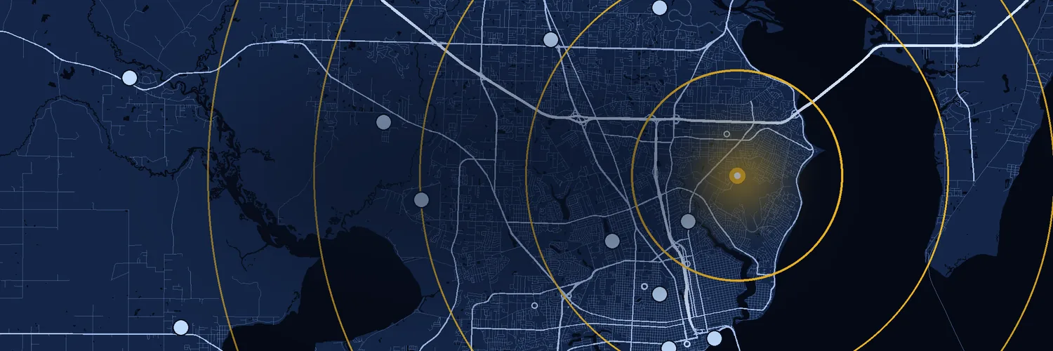
ZIP Code Radius Finder
Every ZIP Code within a distance of any ZIP Code, measured by its real boundaries, not just its center point.
Every ZIP Code within a distance of any ZIP Code, measured by its real boundaries, not just its center point.
About 575,000 people · 243,000 households · parts of 6 counties in IN, KY · See who lives here
Spatial count: every ZIP Code the circle touches, counted by how much of it is inside. Count by center point instead
Who lives within 10 miles of 40214. American Community Survey 5-year estimates, 2020-2024.
Largest group: 25-34, 15% of people. Census age groups are 5 or 10 years wide, so the wider ones look bigger.
| Age | People | Share |
|---|---|---|
| Under 5 | 33,800 | 6% |
| 5-9 | 33,000 | 6% |
| 10-14 | 37,700 | 7% |
| 15-19 | 36,700 | 6% |
| 20-24 | 39,100 | 7% |
| 25-34 | 87,100 | 15% |
| 35-44 | 76,600 | 13% |
| 45-54 | 67,900 | 12% |
| 55-59 | 34,800 | 6% |
| 60-64 | 37,800 | 7% |
| 65-74 | 57,200 | 10% |
| 75-84 | 24,100 | 4% |
| 85+ | 9,610 | 2% |
About 294,000 female and 282,000 male.
| Sex | People | Share |
|---|---|---|
| Female | 294,000 | 51.0% |
| Male | 282,000 | 49.0% |
Largest group: White, 58% of people. Hispanic or Latino people can be of any race; the race groups count everyone else.
| Group | People | Share |
|---|---|---|
| Hispanic or Latino | 56,000 | 10% |
| White | 334,000 | 58% |
| Black | 138,000 | 24% |
| Asian | 13,300 | 2% |
| Am. Indian, Alaska Native | 591 | <1% |
| Pacific Islander | 232 | <1% |
| Some other race | 2,590 | <1% |
| Two or more races | 30,900 | 5% |
Largest group: $50-75k, 18% of households.
| Income | Households | Share |
|---|---|---|
| Under $10k | 16,100 | 7% |
| $10-15k | 12,200 | 5% |
| $15-25k | 20,100 | 8% |
| $25-35k | 21,100 | 9% |
| $35-50k | 31,900 | 13% |
| $50-75k | 44,300 | 18% |
| $75-100k | 30,700 | 13% |
| $100-150k | 37,200 | 15% |
| $150-200k | 14,800 | 6% |
| $200k+ | 14,500 | 6% |
61% of people 16 and older have a job. The unemployment rate is 6%.
| Work | People | Share |
|---|---|---|
| Employed | 282,000 | 61% |
| Unemployed | 17,500 | 4% |
| Armed Forces | 780 | <1% |
| Not in the labor force | 162,000 | 35% |
94% of people have health insurance. Some have both private and public coverage, so the kinds add up to more than the total.
| Health insurance | People | Share |
|---|---|---|
| Any coverage | 532,000 | 94% |
| Private | 346,000 | 61% |
| Public | 258,000 | 45% |
| No coverage | 36,700 | 7% |
Largest group: $200-300k, 28% of owned homes.
| Home value | Owned homes | Share |
|---|---|---|
| Under $50k | 8,180 | 6% |
| $50-100k | 10,900 | 8% |
| $100-150k | 19,700 | 14% |
| $150-200k | 30,600 | 22% |
| $200-300k | 39,300 | 28% |
| $300-500k | 23,700 | 17% |
| $500k-1M | 7,560 | 5% |
| $1M+ | 1,730 | 1% |
Largest group: $1,000-1,500, 41% of renters paying rent.
| Monthly rent | Renters | Share |
|---|---|---|
| Under $500 | 10,400 | 11% |
| $500-1,000 | 31,600 | 33% |
| $1,000-1,500 | 40,200 | 41% |
| $1,500-2,000 | 11,700 | 12% |
| $2,000-2,500 | 2,240 | 2% |
| $2,500-3,000 | 511 | 1% |
| $3,000+ | 503 | 1% |
Largest group: Drove alone, 72% of workers.
| Getting to work | Workers | Share |
|---|---|---|
| Drove alone | 200,000 | 72% |
| Carpooled | 25,600 | 9% |
| Public transit | 5,320 | 2% |
| Walked | 6,040 | 2% |
| Other | 5,660 | 2% |
| Worked from home | 33,900 | 12% |
Largest group: Single-family, 64% of homes.
| Kinds of homes | Homes | Share |
|---|---|---|
| Single-family | 170,000 | 64% |
| Townhouse | 7,940 | 3% |
| 2-4 units | 29,000 | 11% |
| 5-19 units | 32,600 | 12% |
| 20+ units | 23,000 | 9% |
| Mobile home | 5,150 | 2% |
| Boat, RV, van | 98 | <1% |
Figures add up every ZIP Code in the radius, each counted by the share of its area inside the circle (people are assumed to be spread evenly across a ZIP Code). "Typical" values are medians estimated from each ZIP Code's median, so they are approximate. PO Box and single-address ZIP Codes have no area of their own; their residents are counted in the ZIP Codes around them. Source: U.S. Census Bureau, American Community Survey 5-year Data Profiles.
Sorted by distance from 40214. Select a column heading to sort.
| ZIP Code | City | County | State | Miles Distance from 40214 to each ZIP Code's center point. A spatial count lists every ZIP Code the circle touches, so one whose center is just outside the circle can still be listed. | Inside How much of the ZIP Code's area is inside the circle. "Point" ZIP Codes are PO Box or single-address ZIP Codes with no area of their own. |
|---|---|---|---|---|---|
| 40214 | Louisville | Jefferson | KY | 0.0 | All |
| 40215 | Louisville | Jefferson | KY | 2.1 | All |
| 40221 PO Box | Louisville | Jefferson | KY | 2.5 | Point |
| 40209 | Louisville | Jefferson | KY | 2.6 | All |
| 40256 PO Box | Louisville | Jefferson | KY | 3.7 | Point |
| 40208 | Louisville | Jefferson | KY | 3.7 | All |
| 40216 | Louisville | Jefferson | KY | 3.8 | All |
| 40292 Unique | Louisville | Jefferson | KY | 4.0 | All |
| 40268 PO Box | Louisville | Jefferson | KY | 4.6 | Point |
| 40217 | Louisville | Jefferson | KY | 4.7 | All |
| 40258 | Louisville | Jefferson | KY | 4.7 | All |
| 40213 | Louisville | Jefferson | KY | 4.7 | All |
| 40210 | Louisville | Jefferson | KY | 4.8 | All |
| 40118 | Fairdale | Jefferson | KY | 5.0 | All |
| 40211 | Louisville | Jefferson | KY | 5.2 | All |
| 40231 PO Box | Louisville | Jefferson | KY | 5.3 | All |
| 40285 PO Box | Louisville | Jefferson | KY | 5.3 | Point |
| 40287 Unique | Louisville | Jefferson | KY | 5.3 | Point |
| 40289 Unique | Louisville | Jefferson | KY | 5.3 | Point |
| 40290 PO Box | Louisville | Jefferson | KY | 5.3 | Point |
| 40293 | Louisville | Jefferson | KY | 5.3 | Point |
| 40294 Unique | Louisville | Jefferson | KY | 5.3 | Point |
| 40295 PO Box | Louisville | Jefferson | KY | 5.3 | Point |
| 40296 Unique | Louisville | Jefferson | KY | 5.3 | Point |
| 40297 Unique | Louisville | Jefferson | KY | 5.3 | Point |
| 40298 PO Box | Louisville | Jefferson | KY | 5.3 | Point |
| 40219 | Louisville | Jefferson | KY | 5.4 | All |
| 40201 PO Box | Louisville | Jefferson | KY | 5.8 | Point |
| 40232 PO Box | Louisville | Jefferson | KY | 5.9 | Point |
| 40233 PO Box | Louisville | Jefferson | KY | 5.9 | Point |
| 40259 PO Box | Louisville | Jefferson | KY | 6.0 | Point |
| 40251 PO Box | Louisville | Jefferson | KY | 6.1 | Point |
| 40204 | Louisville | Jefferson | KY | 6.3 | All |
| 40203 | Louisville | Jefferson | KY | 6.3 | All |
| 40270 PO Box | Louisville | Jefferson | KY | 6.4 | Point |
| 40282 Unique | Louisville | Jefferson | KY | 6.4 | Point |
| 40266 Unique | Louisville | Jefferson | KY | 6.5 | Point |
| 40281 Unique | Louisville | Jefferson | KY | 6.5 | Point |
| 40283 Unique | Louisville | Jefferson | KY | 6.5 | Point |
| 40205 | Louisville | Jefferson | KY | 6.7 | All |
| 40202 | Louisville | Jefferson | KY | 6.8 | All |
| 40255 PO Box | Louisville | Jefferson | KY | 6.9 | Point |
| 40261 PO Box | Louisville | Jefferson | KY | 6.9 | Point |
| 40218 | Louisville | Jefferson | KY | 7.2 | All |
| 40109 | Brooks | Bullitt | KY | 7.4 | All |
| 40225 Unique | Louisville | Jefferson | KY | 7.4 | Point |
| 40212 | Louisville | Jefferson | KY | 7.5 | All |
| 40272 | Louisville | Jefferson | KY | 7.6 | 90% |
| 40280 Unique | Louisville | Jefferson | KY | 7.9 | Point |
| 40206 | Louisville | Jefferson | KY | 7.9 | All |
| 47131 PO Box | Jeffersonville | Clark | IN | 8.2 | Point |
| 47132 Unique | Jeffersonville | Clark | IN | 8.2 | Point |
| 47133 Unique | Jeffersonville | Clark | IN | 8.2 | Point |
| 47134 Unique | Jeffersonville | Clark | IN | 8.2 | Point |
| 47144 Unique | Jeffersonville | Clark | IN | 8.2 | Point |
| 47199 Unique | Jeffersonville | Clark | IN | 8.2 | Point |
| 40228 | Louisville | Jefferson | KY | 8.3 | 90% |
| 40129 PO Box | Hillview | Bullitt | KY | 8.8 | Point |
| 47151 PO Box | New Albany | Floyd | IN | 8.9 | Point |
| 40229 | Louisville | Jefferson | KY | 9.0 | 79% |
| 47190 PO Box | Jeffersonville | Clark | IN | 9.1 | All |
| 40041 | Masonic Home | Jefferson | KY | 9.1 | All |
| 47150 | New Albany | Floyd | IN | 9.2 | 56% |
| 40220 | Louisville | Jefferson | KY | 9.3 | 57% |
| 40224 PO Box | Louisville | Jefferson | KY | 9.4 | Point |
| 40250 PO Box | Louisville | Jefferson | KY | 9.4 | Point |
| 40207 | Louisville | Jefferson | KY | 10.0 | 51% |
| 47129 | Clarksville | Clark | IN | 10.5 | 40% |
| 47136 | Lanesville | Harrison | IN | 11.1 | 26% |
| 40291 | Louisville | Jefferson | KY | 12.0 | 16% |
| 47117 | Elizabeth | Harrison | IN | 12.2 | 32% |
| 40177 | West Point | Hardin | KY | 12.5 | 2% |
| 47130 | Jeffersonville | Clark | IN | 12.8 | 13% |
| 40165 | Shepherdsville | Bullitt | KY | 13.3 | 14% |
| 40299 | Louisville | Jefferson | KY | 14.5 | 2% |
| 47122 | Georgetown | Floyd | IN | 14.6 | <1% |
A ZIP Code isn't a shape drawn on a map. It's a set of mail delivery routes, so its truest outline is the area those routes cover. Our radius measures that area.
Most radius tools check only each ZIP Code's center. A ZIP Code that reaches well into the circle is left out when its center is outside, and one that is barely inside counts in full.
The Census Bureau's ZIP Code Tabulation Areas are built from census blocks, not mail routes, and are redrawn only with each census. Most PO Box and single-business ZIP Codes have none.
Built from USPS carrier routes, the lines carriers actually deliver along, and rebuilt every quarter. The spatial radius counts each ZIP Code by how much of it is inside the circle, and its people by the same share.
Need the center-point list instead? Choose Centroid under More options.
The same ZIP Code polygons, for your own maps and analysis: one ZIP Code, a state or the whole U.S., in Shapefile, GeoJSON, KML, WKT, CSV, MySQL, PostGIS or SQL Server. Instant download, with quarterly updates.
Connect Claude or ChatGPT to our ZIP Code data, then ask questions in plain English. No sign-up with us needed.
This question answers in full without a key. Income, homes and most other figures for an area need a free API key.
New to this? We'll walk you through it, one step at a time.
Developer tools: Claude Code, Cursor, VS Code, CodexEverything above came from one call to the ZIP Codes API /v2/radius endpoint: the ZIP Codes in the radius, how much of each is inside, and Census figures for the whole area. The API also returns the same figures for any year from 2011 to 2024, and it searches up to 250 miles.
This search used 5 credits; a free key includes 2,500 a day.
curl -H "X-Api-Key: YOUR_KEY" "https://api.zip-codes.com/v2/radius?code=40214&max=10&mode=spatial&include=acs_demographic,acs_economic,acs_housing,acs_social"
The first three ZIP Codes and the headline figures from the real response. Coordinates are rounded to 3 decimals here; the API returns full precision.
{
  "success": true,
  "request": {
    "code": "40214",
    "max": "10",
    "include": [
      "acs_demographic",
      "acs_economic",
      "acs_housing",
      "acs_social"
    ],
    "mode": "spatial"
  },
  "results": [
    {
      "success": true,
      "search": {
        "center": {
          "code": "40214",
          "code_type": "ZIP",
          "city": "Louisville",
          "state": "KY",
          "location": {
            "lat": 38.162466,
            "lon": -85.7834
          }
        },
        "max": 10,
        "min": 0,
        "mode": "spatial"
      },
      "summary": {
        "total_count": 76,
        "us_zip_count": 76,
        "ca_fsa_count": 0,
        "ca_postal_count": 0
      },
      "matches": [
        {
          "country": "US",
          "code": "40214",
          "code_type": "ZIP",
          "city": "Louisville",
          "state": "KY",
          "county": "Jefferson",
          "county_fips": "21111",
          "classification": null,
          "classification_name": "Standard",
          "location": {
            "lat": 38.163,
            "lon": -85.783
          },
          "distance_miles": 0,
          "pct_inside": 100,
          "area_sq_mi": 15.01
        },
        {
          "country": "US",
          "code": "40215",
          "code_type": "ZIP",
          "city": "Louisville",
          "state": "KY",
          "county": "Jefferson",
          "county_fips": "21111",
          "classification": null,
          "classification_name": "Standard",
          "location": {
            "lat": 38.193,
            "lon": -85.786
          },
          "distance_miles": 2.1,
          "pct_inside": 100,
          "area_sq_mi": 3.51
        },
        {
          "country": "US",
          "code": "40221",
          "code_type": "ZIP",
          "city": "Louisville",
          "state": "KY",
          "county": "Jefferson",
          "county_fips": "21111",
          "classification": "P",
          "classification_name": "PO Box",
          "location": {
            "lat": 38.189,
            "lon": -85.751
          },
          "distance_miles": 2.53,
          "pct_inside": null,
          "area_sq_mi": 0
        }
      ],
      "stats": {
        "acs": {
          "current": {
            "year": 2024,
            "vintage": "2020-2024",
            "aggregation_note": "Values are area-weighted aggregates across all US ZIPs intersecting the radius. Counts use sum(value * pct_inside). Medians and means average each ZIP's value, weighted by the field's own count (households for household income, owner-occupied homes for home value) times pct_inside: a radius median is an estimate, not the median of the combined area. Rates are recomputed from aggregated numerator/denominator. pct follows Census field by field: a share is recomputed from the aggregated sums of the field and the total Census divides it by; a total row's pct is its count; a rate is in whichever column Census prints it, pct with est null (unemployment, recomputed; poverty, a population-weighted average where Census gives no counts) or est with pct null (the housing vacancy rates); pct is null where Census publishes none. ZIPs without ACS data are PO Box, unique and other point ZIPs with no area of their own: Census publishes nothing for them, and their residents are counted in the surrounding ZIPs. No MOE in summary.",
            "demographic": {
              "sex_and_age": {
                "total_population": {
                  "est": 575450,
                  "pct": 575450
                },
                "median_age": {
                  "est": 37.7
                }
              }
            },
            "social": {
              "households": {
                "total": {
                  "est": 242820,
                  "pct": 242820
                }
              },
              "education": {
                "bachelors_or_higher": {
                  "est": 112477,
                  "pct": 28.5
                }
              }
            },
            "economic": {
              "income": {
                "households": {
                  "median": {
                    "est": 62392.3
                  }
                }
              },
              "poverty": {
                "people": {
                  "total": {
                    "est": null,
                    "pct": 17.9
                  }
                }
              }
            },
            "housing": {
              "tenure": {
                "owner_occupied": {
                  "est": 141674,
                  "pct": 58.3
                }
              },
              "value": {
                "median": {
                  "est": 215536.3
                }
              },
              "rent": {
                "median": {
                  "est": 1065.5
                }
              }
            }
          }
        }
      }
    }
  ],
  "meta": {
    "credits": {
      "used": 5
    }
  }
}