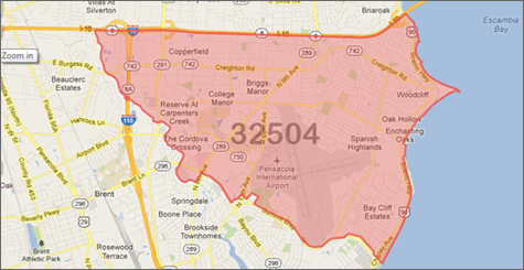
ZIP Code Boundary Data Features
ZIP Code boundaries add perspective to your maps, point you toward the good potential customers, and add relevence to your local search.
ZIP Code Boundaries are:
- Immediate Download. Working on a Saturday and need this data right now? No problem!
- Sourced from the USPS, then enhanced and improved using proprietary processes.
- Compiled with strict methodology and algorithms that align ZIP Code data with streets to eliminate overlaps.
- Comprehensive, providing coverage across the entire United States including Washington DC and Puerto Rico.
- Complete with latitude/longitude for all ZIP Code polygons, and ZIP Code centroids.
- Easy to integrate with other datasets including Neighborhood Boundaries, County Boundaries, City Boundaries, and other GIS databases.
- Our data is updated every quarter, not yearly like other sources.
- These are not ZCTA boundaries, but current USPS defined ZIP Codes.
- Continuous Coverage! Unlike others who have gaps in their boundaries for areas not covered by a ZIP Code, we have filler Polygons that ensure full coverage of the United States.
- Available in multiple major GIS formats:
- ESRI - Shapefile (.shp)
- Google Display - KML (.kml)
- DB Loadable - WKT (.txt)
- DB Loadable - MySQL™ (.sql)
- DB Loadable - SQL Server (.sql)
- DB Loadable - Post GIS (.sql)
- Comma Separated Values (.csv)
Data Fields:
You get more than just the boundaries. These are just some of the data fields also included:
- Name
- ZIP Code Type
- State
- County
- State & County FIPS
- Centerpoint Latitude & Longitude
- Residential Delivery Count
- Business Delivery Count
- P.O. Box Delivery Count
- Single Family Delivery Count
- Multi Family Delivery Count
- Color (for easy mapping)
- See More
Use ZIP Code Boundaries:
- See customer data with actual boundaries for the ZIP Code also shown.
- Include in your own web mashup or interactive map application on the web.
- Use for lead assignment or for routing leads to sales reps or distributors.
- Add ZIP Code layers to your existing Geographic Information System (GIS) such as ESRI's ArcView or MapInfo.
- Internal data analysis of customers, vendors, or any segment imaginable.
- Real ZIP Code boundaries, not a ZIP Code Tabulation Area (ZCTA) like most sites provide from the Census Bureau.

