County Map Boundary Data

High Precision County Boundaries
- Enhanced national data
- Boundary Polygon + Centroid
- Comprehensive national coverage
- Multiple data formats to fit your needs
- Strict methods to align with streets and eliminate overlaps
Available Data Formats:
- ESRI - Shapefile (.shp)
- Google Display - KML (.kml)
- DB Loadable - WKT (.txt)
- DB Loadable - MySQL™ (.sql)
- DB Loadable - SQL Server (.sql)
- DB Loadable - Post GIS (.sql)
- Comma Separated Values (.csv)
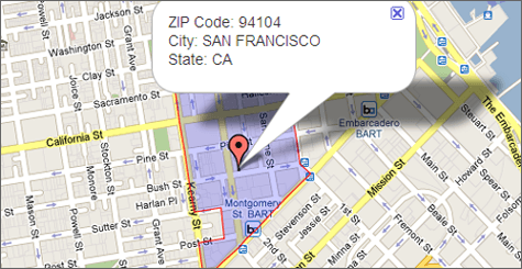
County Boundary Data shows direct marketers where their prospects live, helping them to develop efficient strategies and target campaigns and help web developers add relevance to search capabilities. ZIP Code Boundaries also allow local search by County to display an area on a map with points of interest. Of course, the more accurate the County data, the better the marketing and search results.
Are you using old County data? How much are inaccuracies costing your business? ZIP-Codes has the most accurate County GIS data available. We build County Boundaries from the individual address up and aligns boundaries with streets to represent on-the-ground reality. And, we keep ZIP Code data up-to-date with the frequent changes driven by USPS expansions and consolidation.

